Apple Maps Shows Real-Time Earth Positioning
Last updated on April 22nd, 2015 at 01:28 pm
Posted in TILs by Patricia on February 4, 2015To use this interesting trick on your iPhone or iPad, you have to open the Apple Maps application. Next, make sure that you zoom out, by pinching your device’s display and spreading out your fingers. You need to focus out completely in order to check the real-time earth’s positioning.
 Real-Time Earth Positioning View
Now it’s time to change the map type. This is done by hitting the encircled i icon found in the bottom right corner of the Maps home screen.
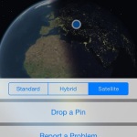
It will unfold a slide menu that allows you to switch for the Satellite view. This way you are able to take a look at a 3D representation of our planet.
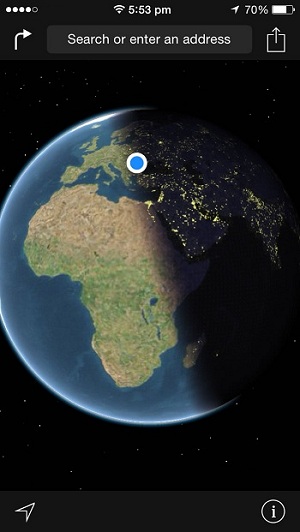
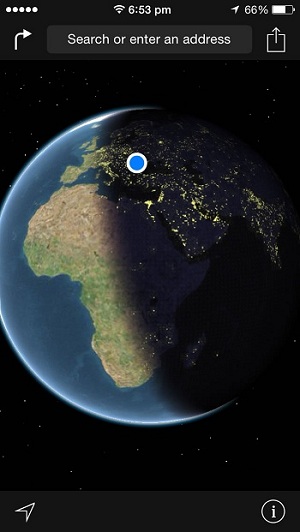
Real-time updates make sure that you are prompted with the actual day and night sides of our globe.
Enable Location Services To See Your Exact Position
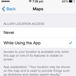
 To make the experience even more real, make sure that your iPhone’s Location Services are turned on and that you allow Apple Maps to access your device’s GPS system while the app is used. GPS functionality is enabled or disabled from Settings -> Privacy -> Location Services.
After you activate your GPS also scroll for the Maps application and make sure that the While Using the App option is enabled. Now, every time when you use Maps and check the 3D satellite view of our planet you’ll see your current location, on the globe, highlighted with the help of a blue dot.
Earth’s Transition Between Day and Night
Below you have an example of how day turns into night as the earth rotates around his axis. First capture is made right at transition between day and night, while the second screenshot is made exactly one hour later. Notice how night advances towards the next timezones, as this face of the planet turns away from the sun.
 |
 |
| Central Europe preparing to make the transition from Day to Night! | Same location, one hour later, you can notice the night side of earth expanding! |

