How To Find Electric Vehicle Charging Stations With Google Maps On iPhone
Google Maps EV charging stations feature.
The EV Stations come with details about the type of ports available, how many of them you can find in a location as well as charging speeds. What’s not available yet is real-time info about how many ports are occupied and how many are free at a given station. However, the EV Stations are also accompanied by the usual information provided by Google, like user ratings, reviews, photos and questions.
How To Search For EV Stations In Google Maps For iOS
1. Make sure that you run the latest version of Google Maps for your iPhone and iPad. Direct download / upload link available here.
2. Open Google Maps.
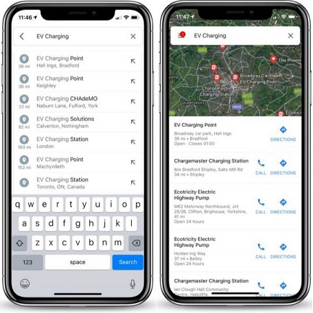
3. Tap the Search field and type “ev charging” or “ev charging stations” and the app will prompt you with the closest stations available that can recharge your electric vehicle.
Important: The ev charging stations supported by Google Maps:
– Worldwide: Tesla, Chargepoint.
– US: SemaConnect, EVgo, Blink.
– UK: Chargemaster, Pod Point.
– AU & NZ: Chargefox.
Related: Do you know that Google Maps also has a Parking difficulty indicator?